
Cleaning the Canal — More Risk to Red Hook

Improving Connectivity: New Bike Lanes, said to come this summer
“Cycling from Park Slope to the Columbia Street Waterfront District is about to get a whole lot easier.
Community Board 6 voted unanimously to approve a city plan to roll out a path for two-wheelers on Sackett Street that would connect to an existing Park Slope route and cross the Gowanus Canal on Union Street — giving bikers a safer ride from the brownstone enclave to Van Brunt Street.”
DOT Proposal
http://www.nyc.gov/html/dot/downloads/pdf/2013-03-bike-route-union-sackett-bk-cb-6.pdf
Related Articles
http://www.brooklynpaper.com/stories/36/20/dtg_sackettbikelane_2013_05_17_bk.html
What form of transit is right for Red Hook?
This gallery contains 4 photos.
New York looking to the Netherlands for flooding solutions
 In the Netherlands polders and dikes and the reshaping of the land can be looked to as a good lesson in water management.
In order for something like this to occur difficult political decisions need to be made, but we see it as the only option in order to cope with rising sea level and storm surge. Protecting the neighborhood and the city should not be treated as a burden, but “as an economic and architectural opportunity.”
Leave a comment
Tour of Recovering Local Businesses
After natural disasters there is a flurry of media coverage and assistance that flood into an affected area. But what happens when the headlines fade as time passes?
Peter Day takes a walk down Van Brunt Street of Red Hook Brooklyn to find out how businesses in this one area are trying to rebuild themselves after the devastation of Hurricane Sandy.
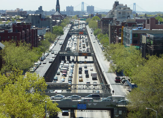
BQE Enhancement

In this 2010 proposal in response to a study prompted by the Economic Development Corporation (EDC), a collaboration between Kiss + Cathcart Architects & Starr Whitehouse Landscape Architects looked at ways to improve the BQE underpass. The issues highest on the agenda were developing east-west access over the underpass and controlling noise and pollution emanating from the depressed highway. The scheme suggests the possibility of removing the highway from view at street level, generating electricity for the surrounding area, and even an opportunity for new retail space. A list of related documents can be found here, on the EDC's website.

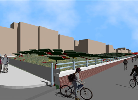


- BQE, Section Looking North
Landform History Exposed

An RFP out to redesign the BQE Underpass

Photo Credit: Atlantic Avenue BID
It’s no secret that the BQE forms a barrier between the neighborhoods that it divides. There is now new interest in revitalizing an underpass that allows pedestrian traffic through – “in the hopes of increasing foot traffic between the businesses along Atlantic Avenue and Brooklyn Bridge Park.”
Atlantic Avenue BID, which has initiated the project and raised its funding, issued the RFP.
via Brownstoner & DNAinfo
Floating Park by N.E.E.D
 In this scheme for “an aquaculture-driven floating park” by N.E.E.D, modules are deployed at the water’s edge to create a structure that houses areas that receive various waterfront programs, mechanical equipment and most curiously, a submerged fish farm and aqua-habitat.


